The future of energy is beneath us.
GeoCaliente 2029 is a research initiative to reveal the geothermal potential beneath southern New Mexico—connecting deep Earth science with a cleaner energy future.
- 280Planned passive seismic nodes
- ~50 × 74km geothermal prospect area
- 2Integrated 2026–27 task orders
- 2029Long-term project vision
A remarkable energy resource. Hidden in plain sight.
The Rio Grande Rift combines elevated regional heat, extensive fault networks, young volcanism, and deep sedimentary basins. Together, these make southern New Mexico a compelling—but still incompletely characterized—geothermal frontier.
Our immediate mission is to reduce exploration uncertainty before expensive drilling decisions are made.
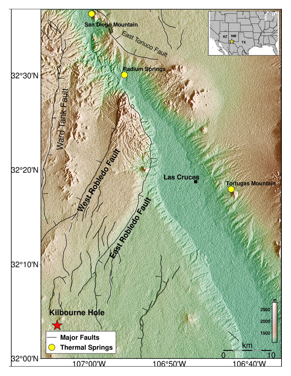
- Las Cruces
- Mesilla Basin
- Radium Springs
- Rio Grande Rift
Follow the heat. Trace the pathways. Find the reservoirs.
GeoCaliente brings together geology, seismology, rock magnetism, geochemistry, and hydrogeology to build an integrated picture of geothermal systems.
-
01 / Heat source
Where is the heat?
Combine heat-flow observations, aeromagnetic Curie-depth estimates, and volcanic-rock studies to investigate the thermal architecture of the crust.
-
02 / Fluid pathways
How does it move?
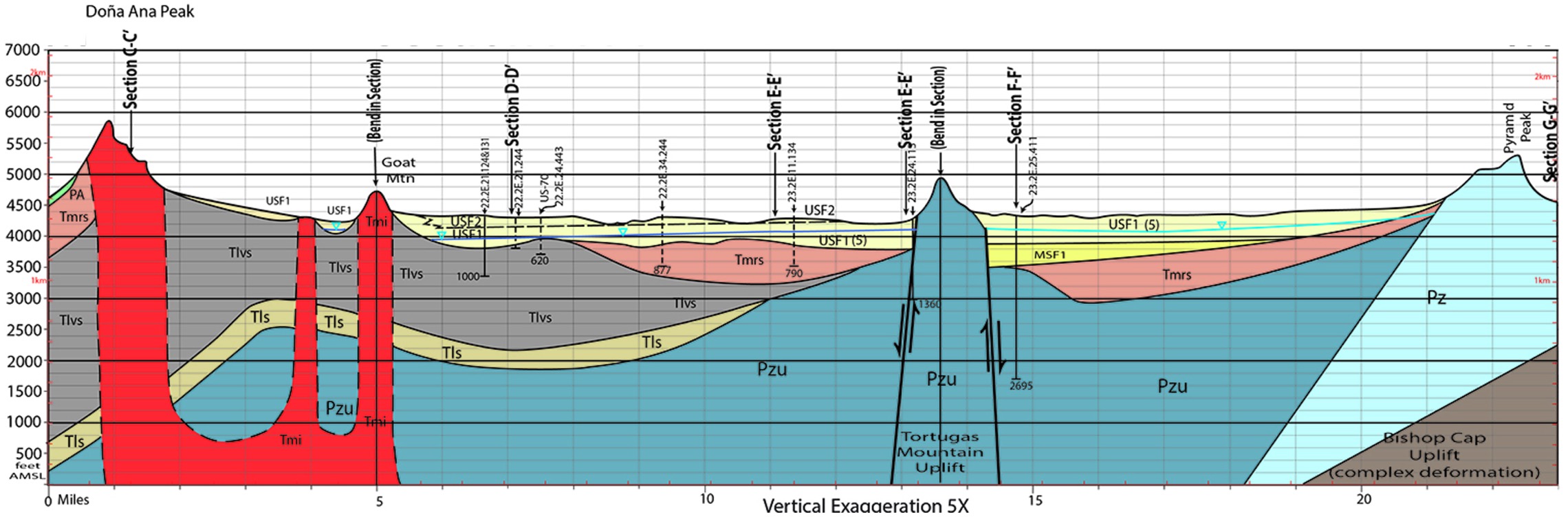
Use fault mapping and passive seismic imaging to examine structures that may allow deeply circulating fluids to rise toward the surface.
-
03 / Reservoirs
Where can it be stored?
Evaluate fractured bedrock, permeable basin sediments, aquifers, and sealing units to identify potential geothermal reservoirs.
Listening to the Earth without drilling.
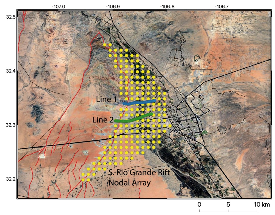
A planned network of 280 three-component seismic instruments will record ambient vibrations across the study area. Researchers will use these recordings to infer subsurface velocity structure, fault geometry, and basin architecture.
In parallel, geological fieldwork and laboratory analyses will investigate fault rocks, hot-spring travertines, Potrillo volcanic rocks, and deep-crustal xenoliths from Kilbourne Hole.
One dataset tells part of the story. Many datasets reveal the system.
Seismic imaging + aeromagnetics + Curie depth + heat flow + geological mapping + geochemistry + hydrogeology → a more defensible geothermal prospect model.
From scientific discovery to informed decisions.
The current state-supported investigation is the foundation for a broader, multi-phase vision. Later stages depend on new funding, scientific findings, and authorizations.
-
2026–2027Current work plan
Map, measure, model.
Passive seismic survey, targeted geological characterization, aeromagnetic and thermal interpretation, integrated conceptual models, reusable datasets, and ranked exploration prospects. No exploration well is authorized under the current task orders.
-
Future visionProposed
Build a 3D subsurface picture.
Expand integration of geologic, geophysical, thermal, and hydrologic data into an advanced three-dimensional model to guide exploration choices.
-
By 2029Aspirational
Evaluate pilot drilling and energy use.
Use the accumulated evidence to assess whether a pilot geothermal well and eventual energy applications for NMSU are technically and economically justified, subject to funding and approvals.
Built on collaboration. Driven by discovery.
Led by the Department of Geological Sciences at New Mexico State University, with expertise from university and geothermal collaborators.
- Eric C. FerréPrincipal Investigator · NMSU
- Alejandro CardonaCo-Investigator · NMSU
- Brian HamptonCo-Investigator · NMSU
- Jennifer ThinesCo-Investigator · NMSU
- Frank RamosCo-Investigator · NMSU
- Natalia VarelaCo-Investigator · NMSU
- Jim WitcherGeothermal specialist
- Patricia PersaudUniversity of Arizona · Seismology
- Dhananjay RavatUniversity of Kentucky · Aeromagnetics
Research that delivers.
The 2026–2027 work plan prioritizes permanent, reusable scientific products for the State of New Mexico and future researchers.
-
Fall 2026
Compile existing data, design seismic array, coordinate access and begin fieldwork.
-
Winter 2026–27
Acquire seismic observations and characterize geological samples.
-
Spring 2027
Process data, integrate results and develop geothermal models and prospect maps.
-
June 2027
Planned final technical report and documented data archive for ECAM.
Department of Geological Sciences · Las Cruces, New Mexico. Research supported through the New Mexico Energy, Minerals and Natural Resources Department, Energy Conservation and Management Division (ECAM).